
client: Märkisches Museum Berlin (Stadtmuseum)
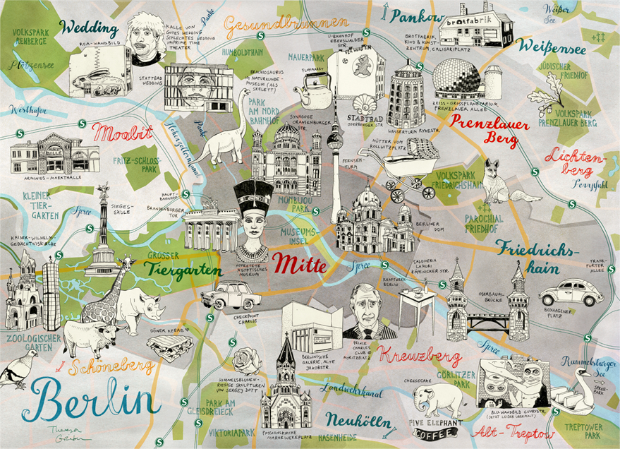
› This is my colorful hand drawn map of the central districts and sights of Berlin.
I show the city centre Mitte, plus the popular precincts of Kreuzberg, Friedrichshain,
Prenzlauer Berg, Wedding and Tiergarten/Moabit. For each district I've drawn icons
of typical buildings, people, animals and street art.
› Inspired by this map I was commissioned to illustrate a large interactive Berlin map
at Märkisches Museum Berlin (Stadtmuseum) for their permanent exhibition BerlinZEIT
(running until the end of 2020). The map welcomes each visitor at the beginning of
the exhibtion and covers an area of 6 x 3 meters. It shows all central Berlin districts
and their highlights along with video screens, sound effects and inset object boxes.

BerlinZEIT exhibition at Märkisches Museum Berlin (Stadtmuseum) / Music: www.bensound.com
› I've also turned this map illustration into a Set of 5 Postcards, which show
Mitte, Kreuzberg-Friedrichshain, Wedding, Tiergarten and Prenzlauer Berg separately.

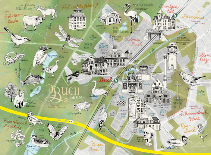
› Another map of Berlin-Buch, where I grew up and used to go to school. It is
permanently on sale as a high quality art print in my online shop.
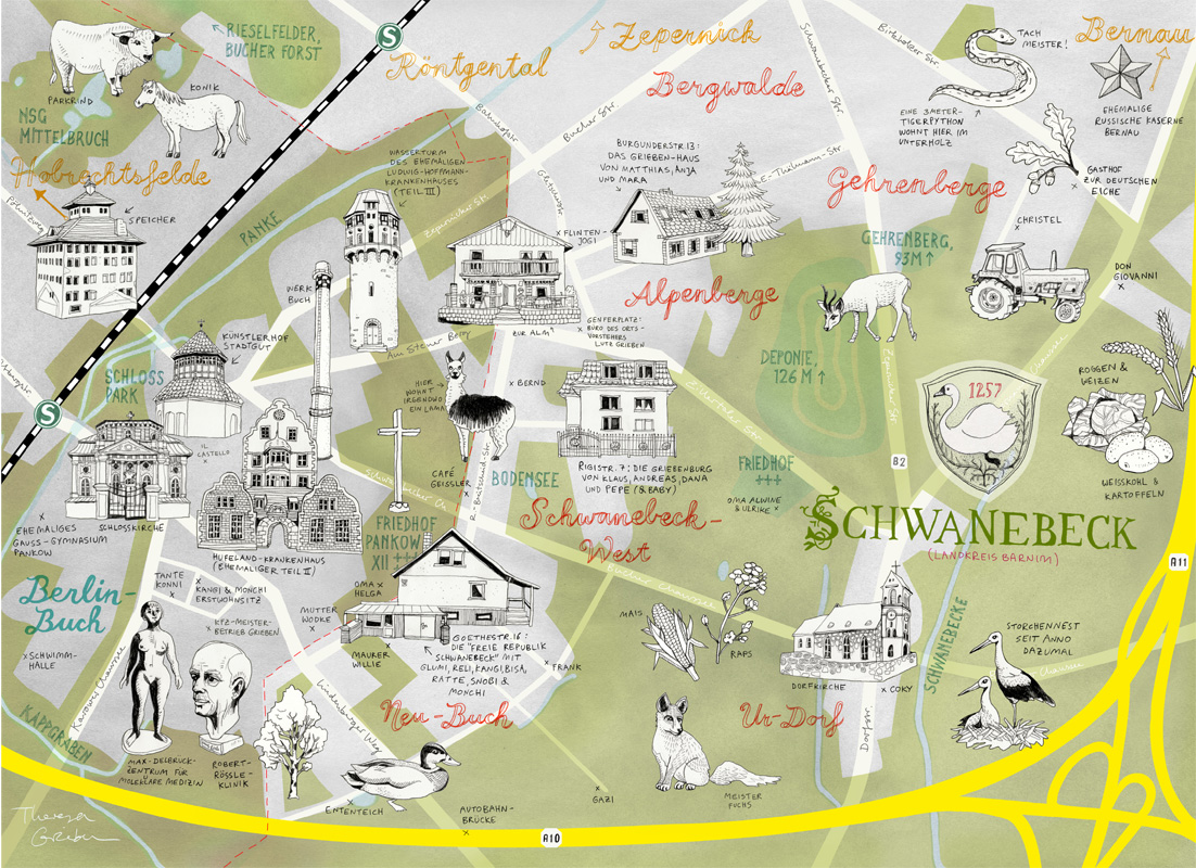
› ...and another map of Schwanebeck (Panketal) right East of Berlin-Buch.
This map was a gift for my father, who's the district major of Schwanebeck.